All content and media files are published under a Creative Commons Attribution-ShareAlike 4.0 International License (CC BY-SA 4.0)
Nantahala - the land of the midday sun
Raleigh, North Carolina and surrounding
Nature Reserves, Safari Parks, Zoo
Address: Nantahala
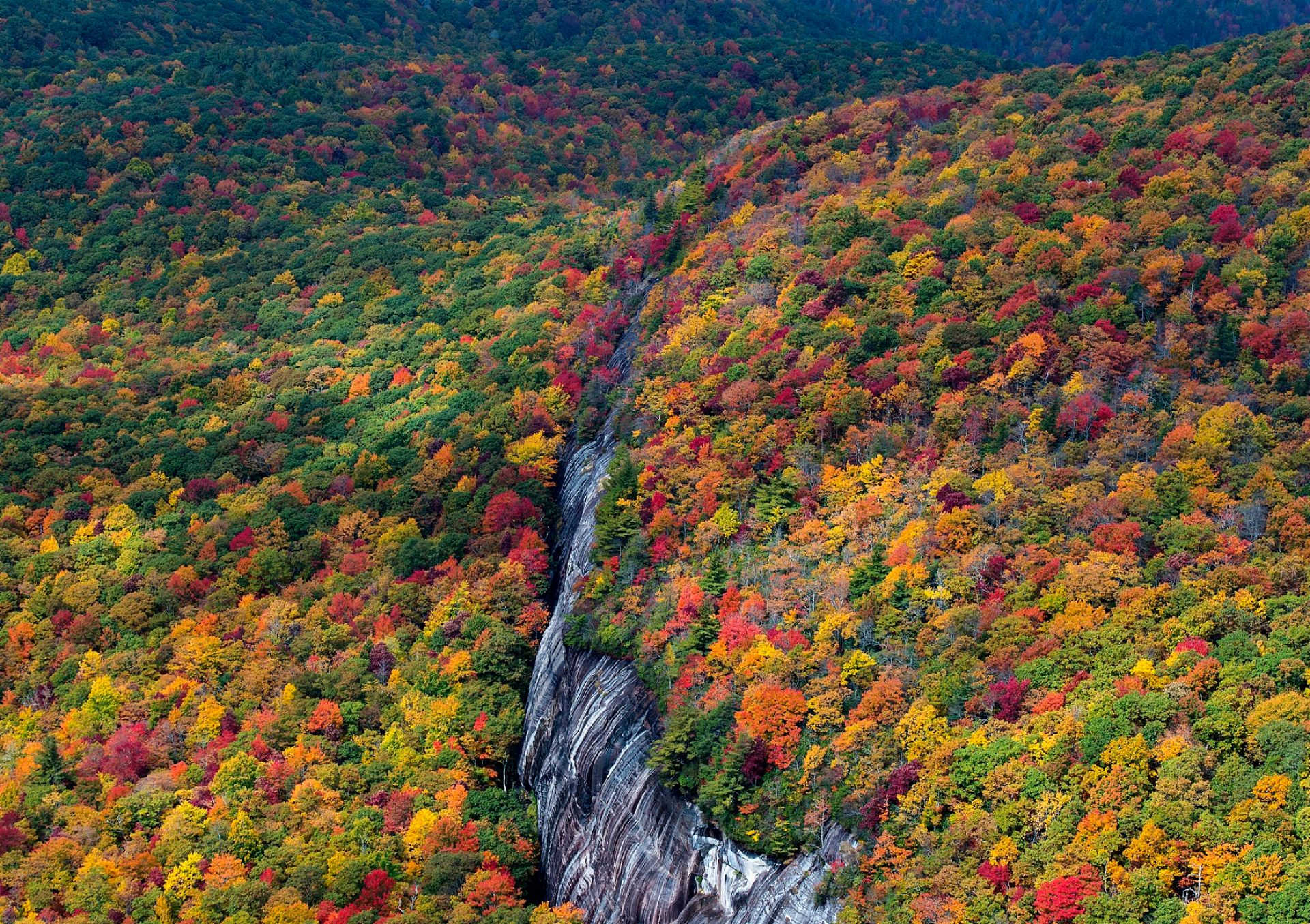
Nantahala National Forest was founded in 1920. The word "Nantahala" was derived from the language of the Cherokee tribe. It means “the land of the midday sun”.
This name says it all. In some parts of the forest, the sun illuminates the bottom of deep gorges only at noon, at its zenith. Among the thickets, the river Nantahala flows.
Nantahala National Forest, located in the mountains and valleys of western North Carolina, is the largest forest of four in this region. The topography varies from 1,767 meters in Lone Lysom, Jackson County, to 365 meters in Cherokee County, below the Appalachian Dam. Its total area is more than 2000 square meters.
This place includes many waterfalls. All the water flowing from the mountains comes here. You meet a small or large waterfall at every turn. All it creates unique “music”. Locals even joke that trees and water sing and talk to each other.
The popular Appalachian hiking trail runs through the forest. It leads travelers to all sites of Nantahala.
Cheoa Ranger District, which means otter in the Cherokee language, is famous for its four large mountain reservoirs and various streams. The Joyce Kilmer Memorial Forest is also located here.
The largest part of the forest is the Nantahala Ranger District. It attracts tourists with Indian Mountain, Gorges of Nantahala and Wayah Bald. You can go to the sea by a trail in this district.
To the Tusquitee Ranger District (“where the water dogs laughed” in the local dialect), people come from all districts to catch trout. Among the attractions are the Hiawassee River, Mount Jackrabbit, Lake Chatuge, Lake Hiawassee, and Appalachian Mountains Lake.
The entrance to the Nantahala National Forest is free. You just need to take equipment with you. Amateurs tourists need to take an organized tour. Otherwise, they can get lost among the trails, trees, and waterfalls.